Ecosystem Monitoring in Mount Hope Bay
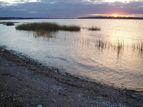
The environmental health of Mount Hope Bay, in southeastern Massachusetts, has suffered through the long-term and cumulative effects of poorly planned economic growth and development. As a result, Mount Hope Bay is showing signs of an impaired ecosystem. Bottom-dwelling finfish populations, such as winter flounder, have declined to worrisome levels.
The declining environmental health of the Bay, an increase in demands for electric power generation at a nearby point station, and renewals of the National Pollution Discharge Elimination System (NPDES) permits influenced several governmental agencies to review the overall ecological health and the future of Mount Hope Bay.

YSI environmental monitoring systems were first deployed in the summer of the late ‘90s to provide continuous real-time monitoring. The Massachusetts Office of Coastal Zone Management wanted to discover if the low dissolved oxygen events in the Bay were a result of in situ processes or advection of water from the Taunton River. The Office also wanted to define the logistics of remote sensing, data gathering and utilization, and protocols for calibration.
An integral part of an estuary’s ecological cycle is the microbial decomposition of organic matter. This process consumes oxygen. If added in sufficient quantities, organic matter decomposition can lead to a rapid decline in dissolved oxygen. An overload of nutrients may further exacerbate the problem by stimulating an overgrowth of phytoplankton that in turn decompose and contribute to the depletion of water column dissolved oxygen. Water quality monitoring is required to understand the extent and nature of these processes before effective management can take place.
YSI Instruments Monitor Bay
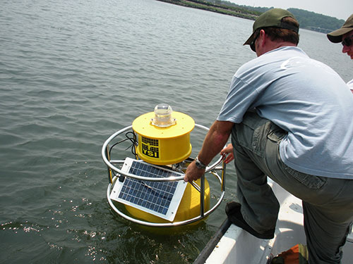
YSI environmental monitoring systems have been recording data that indicates the health of the bay. A YSI multiparameter sonde is hung in mid-water column from a YSI buoy. The sonde records dissolved oxygen, temperature, and conductivity. It sends the information in fifteen-minute intervals to a YSI Data Acquisition System that is installed in the buoy.
The data is uploaded daily to the Coastal Zone Management’s office in Boston via a cellular modem. YSI’s software is used to analyze the data and print reports. For decades, Mount Hope Bay has received contaminants from industrialization and economic growth. These contaminants in part come from the Taunton River, wastewater treatment plants, and combined sewer overflows.

YSI offers a variety of buoys depending on the application. Shown here is a smaller buoy easily lowered from a boat, such as the DB600 data buoy.
Recent observations of continuously monitored dissolved oxygen in the upper portion of the Bay have documented changes in surface water dissolved oxygen levels from 9.7 mg/L to less than 1 mg/L occurring over a period of about 30 hours. This data is alarming because significant impairment of numerous aquatic species occurs when exposure falls below 3 mg/L.
It is also to point out that without continuous water quality monitoring instrumentation, these events may have been lost. While spot sampling is extremely important in an overall water quality study, it's imperative to have continuous monitoring to determine such large fluctuations. Spot sampling may have occurred at times when the DO readings were high and a false sense of success may have been assumed. The continuous monitoring allowed for diurnal cycles to be monitoring completely.
The Massachusetts Department of Environmental Protection classifies most of the Massachusetts portion of the Bay as Class SA. SA means that the waters “…are designated as an excellent habitat for fish, other aquatic life and wildlife and for primary and secondary contact recreation.” (1995 Revisions of 314 Code of MA Regulation 4.00). These regulations also specify that dissolved oxygen shall not be less than 6.0 mg/L unless background conditions are lower. Data that is collected from the Mount Hope Bay monitoring project will help make informed management decisions about the Bay’s future.
To learn more about the final EMPACT report for the Mount Hope Bay and Narragansett Bay projects visit the EPA website.

Additional Blog Posts of Interest
Advanced Water Quality Assessment Program | Ferries for Science
Estuary Research Project Highlights Advantages of Continuous Monitoring
Sea Level Rise Research: Clam Bayou Estuary Florida
The Evolution of Water Quality Monitoring [Free eBook]